The M2C citation cartel often cites Brother John E. Clark.
Brother Clark wrote the entry in the Encyclopedia of Mormonism titled
"Book of Mormon Geography." I think he did an excellent job summarizing the official
Church positions on this topic and setting out the cautions we should all keep
in mind when we study the geography and historicity issues. However, he spends
a lot of time on criteria that don't appear in the text, which is problematic.
I don't know how many people read the Encyclopedia of
Mormonism any longer, but it's online and comes across as
authoritative. I'd like to see it corrected and edited, so I offer my peer
review here.
_________
Here is the article, with emphasis added and my comments
in red.
Book of Mormon Geography
See this
page in the original 1992 publication.
Author:
Clark, John E.
Although
the Book of Mormon is primarily a
religious record of the Nephites, Lamanites, and Jaredites, enough geographic
details are embedded in the narrative to allow reconstruction of at least a
rudimentary geography of Book of Mormon lands. In the technical usage of the
term "geography" (e.g., physical, economic, cultural, or political),
no Book of Mormon geography has yet been written. Most Latter-day
Saints who write geographies have in mind one or both of two activities: first,
internal reconstruction of the relative size and configuration of Book of
Mormon lands based upon textual statements and allusions; second, speculative
attempts to match an internal geography to a location within North or South America.
[Comments. Many people do attempt an internal reconstruction, but they soon discover that no two people can independently come up with the same "internal geography." That’s because the text does not give two basic requirements: distance and direction.
The effort to develop a consensus about any
particular "internal geography" is a pointless academic exercise. At
best, you might get a few people to agree on some assumptions.
Academics typically claim "expertise"
and seek to impose their assumptions on others. When enough of them agree, they
produce a consensus that, through the academic cycle, becomes the de facto
standard within a generation or two.
In my
view, the only possible way to develop a geography is to start with a known
location--a pin in the map. I see no way to get around this.]
Three
questions relating to Book of Mormon geography are discussed here: (1) How can
one reconstruct a Book of Mormon geography? (2) What does a Book of Mormon
geography look like? (3) What hypothetical locations have been suggested for
Book of Mormon lands?
RECONSTRUCTING
INTERNAL BOOK OF MORMON GEOGRAPHY. Although Church leadership officially
and consistently distances itself from issues regarding Book of Mormon
geography in order to focus attention on the spiritual message of the book,
private speculation and scholarship in this area have been abundant. Using
textual clues, laymen and scholars have formulated over sixty possible
geographies.
[The
actual number is the number of people who have sought to develop an internal
geography, because no two people can possibly come up with the identical
version. It requires pure guesswork for both distance and direction.]
Dissimilarities
among them stem from differences in (1) the interpretation of scriptural passages
and statements of General Authorities; (2) procedures for reconciling
scriptural information; (3) initial assumptions concerning the text and
traditional LDS identification of certain features mentioned (especially the
hill Cumorah and the "narrow neck of land," which figure prominently
in the text); and (4) personal penchants and disciplinary training.
[Fair
enough.]
Those
who believe that reconstructing a Book of Mormon geography is possible must
first deal with the usual problems of interpreting historical texts. Different
weights must be given to various passages, depending upon the amount and
precision of the information conveyed. Many Book of Mormon
cities cannot be situated because of insufficient textual information; this is
especially true for Lamanite and Jaredite cities.
[I
disagree with this because no Book of Mormon cities can be
situated without a known reference point, or pin in the map.]
The
Book of Mormon is essentially a Nephite record, and most geographic elements
mentioned are in Nephite territory.
From
textual evidence, one can approximate some spatial relationships of various
natural features and cities. Distances in the Book of Mormon are recorded in
terms of the time required to travel from place to place. The best information
for reconstructing internal geography comes from the accounts of wars between
Nephites and Lamanites during the first century B.C., with more limited
information from Nephite missionary journeys. Travel distance can be
standardized to a degree by controlling, where possible, for the nature of the
terrain (e.g., mountains versus plains) and the relative velocity (e.g., an
army's March versus travel with children or animals). The elementary internal
geography presented below is based on an interpretation of distances thus
standardized and directions based on the text.
[This is
completely illusory. "Standardizing" a guess doesn't make it reliable
or accurate. Even the assumptions about terrain are guesswork.]
AN
INTERNAL BOOK OF MORMON GEOGRAPHY. Numerous attempts have been made to
diagram physical and political geographies depicting features mentioned in the
text, but this requires many additional assumptions and is
difficult to accomplish without making approximate relationships appear
precise (Sorenson, 1991). The description presented below of the size
and configuration of Book of Mormon lands and the locations of settlements
within it summarizes the least ambiguous evidence.
[Brother
Clark acknowledges the problems here, but as we'll see, he makes a cascading
series of assumptions designed to lead to his predetermined outcome, not an
objective analysis.]
Book
of Mormon lands were longer from north to south than from east to west.
[Nothing
in the text requires this.]
They
consisted of two land masses connected by an isthmus ("a narrow neck of
land") flanked by an "east sea" and a "west sea" (Alma
22:27, 32).
[It's
always fun to misquote the scriptures. The phrase "narrow neck of
land" appears only one time in the text--in Ether 10:20. Alma 22:32 refers
to "a small neck of land between the land northward and the land
southward." M2C scholarsalways conflate different terms, of course, but
here Brother Clark puts the wrong phrase in quotations.
How many readers are going to check the reference to see it's incorrectly
quoted? Note that Alma 22:32 also says "the land of Nephi and the land of
Zarahemla were nearly surrounded by water," a passage that completely
disqualifies Mesoamerica. Mesoamerica is called Central America because it is
connected on both ends to North and South America; i.e., far from being nearly
surrounded by water, Mesoamerica extends into huge land masses.]
The
land north of the narrow neck was known as the "land northward" and
that to the south as the "land southward" (Alma 22:32).
[The
division between the two lands is a small neck, not a narrow neck.
My question is, how could an editor allow these obvious errors reach print? I
can understand how a Mesoamerican seer would conflate the terms--they literally
can't unsee their Mesoamerican geography--but wouldn't an editor catch
this?]
The
Jaredite narrative took place entirely in the land northward (Omni 1:22; Ether
10:21),
[the
scriptures don't require this, so a qualifier would be helpful here]
but
details are insufficient to place their cities relative to one another.
[Agreed.]
Most
of the Nephite narrative, on the other hand, took place in the land southward.
Travel accounts for the land southward indicate that the Nephites and Lamanites
occupied an area that could be traversed north to south by normal travel in
perhaps thirty days.
["Perhaps"
saves this assertion, because the text says no such thing. This paragraph seems
to be an exercise in trying to make the scriptures less ambiguous by assuming
ambiguity away, conflating terms, etc. So far, we've learned nothing about the
text's description of the geography.]
The
land southward was divided by a "narrow strip of wilderness" that ran
from the "sea east" to the "sea west" (Alma 22:27).
[I agree
that the lands of the Nephites and Lamanites were divided by the narrow strip
of wilderness--and I'm very glad Brother Clark didn't write "narrow strip
of mountainous wilderness here--but I don't agree that the text says it was the
"land southward" that was divided or that this strip of wilderness
ran from the sea east to the sea west. I've shown elsewhere that it was the
territory itself, not the strip of wilderness, that ran from one sea to the
other.]
Nephites
occupied the land to the north of this wilderness, and the Lamanites, that to
the south.
[Agreed.]
Sidon,
the only river mentioned by name, ran northward between eastern and western
wildernesses from headwaters in the narrow strip of wilderness (Alma 22:29).
[Seriously?
The text doesn't say the river Sidon flowed northward, and it never uses the
term headwaters. This is pure Mesoamerican seership.]
The
Sidon probably emptied into the east sea-based on the description of the east
wilderness as a rather wide, coastal zone-but its mouth is nowhere
specified.
["Probably"
doesn't save this unjustifiable speculation. First, the text refers to four
seas: east, west, north, south. It also refers to the sea west south, which I
take to mean there were at least two seas west (a north and a south). Of
course, this doesn't fit a Mesoamerican geography, so M2C scholars claim that
either 1) the four seas are metaphorical, or 2) the Pacific was both the sea
west and the sea south. It's not clear what Brother Clark means by saying a
north-flowing river empties into the east sea, but maybe in his view the east
sea is also the north sea? At any rate, none of this sentence matches the
scripture, except the acknowledgement that the mouth of Sidon is nowhere
specified--unless the head is the mouth, which it is in some usages.]
The
relative locations of some important Nephite cities can be inferred from the
text. Zarahemla was the Nephite capital in the first century B.C. That portion
of the land southward occupied by the Nephites was known as the "land of
Zarahemla" (Hel. 1:18).
[I can't
tell if this is an erroneous citation or just another speculation, but Helaman
1:18 says nothing about the land southward.]
The
city of Nephi, the original Nephite colony, by this time had been occupied by
Lamanites and served at times as one of their capitals for the land south of
the narrow wilderness divide (Alma 47:20). Based upon the migration
account of Alma 1, the distance between the cities of Zarahemla
and Nephi can be estimated to be about twenty-two days' travel by a company
that includes children and flocks, mostly through mountainous terrain
(cf. Mosiah
23:3;24:20, 25).
[This
"mountainous terrain" is visible in the text only to Mesoamerican
seers. The term "mountain" appears five times in Mosiah, all in the
same quotation from Isaiah 52:7. The M2C scholars read "mountain"
into the text because there are mountains in Mesoamerica, not because Joseph
dictated that word.]
The
distance from Zarahemla to the narrow neck was probably less than that between
Zarahemla and Nephi. The principal settlement near the narrow neck was the city
of Bountiful, located near the east sea (Alma
52:17-23). This lowland city was of key military importance in controlling access
to the land northward from the east-sea side.
[I get it
now. Brother Clark thinks this is among the "least ambiguous
evidence" because he has a particular geography in mind. None of this
speculation is in the text, of course, as anyone can see by referring to the
cited passage.]
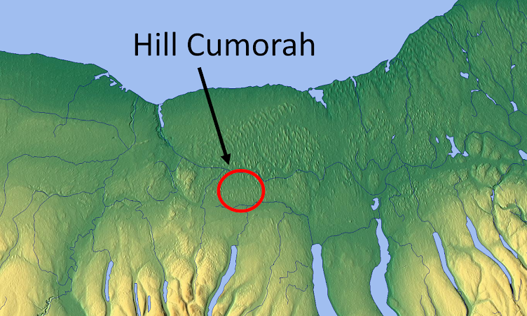
The
relative location of the hill Cumorah is most tenuous, since travel time from
Bountiful, or the narrow neck, to Cumorah is nowhere specified. Cumorah was
near the east sea in the land northward, and the limited evidence suggests that
it was probably not many days' travel from the narrow neck of land (Mosiah 8:8; Ether 9:3). It is also probable that
the portion of the land northward occupied by the Jaredites was smaller than
the Nephite-Lamanite land southward.
[Although
the cited scriptures don't even mention the narrow neck of land--only Ether
10:20 does--I don't disagree with this speculation.
Book
of Mormon lands encompassed mountainous wildernesses, coastal plains, valleys,
a large river, a highland lake, and lowland wetlands.
[The only
mountains mentioned in the text are those from which the Gadianton robbers
sallied forth--and those were mountains and hills. Mountains were distinct from
the wilderness every time the two are mentioned (Hel. 11:25, 31; 3 Nephi 3:20;
4:1). Only M2C scholarsfind "mountainous wilderness" in the text. No
coastal plains are mentioned; all the plains are in the interior of the land.
One river is named, but other rivers are mentioned. No highland lake is in the
text; that's an invention of the Mesoamerican seers, as are the lowland
wetlands.]
The
land also apparently experienced occasional volcanic eruptions and earthquakes
(3 Ne.
8:5-18).
[More fun
with volcanoes! And this is supposedly among the "least ambiguous
evidence" in the text? There is not a single reference to a volcano in the
text Joseph translated, but the M2C scholarsfind it anyway.]
Culturally,
the Book of Mormon describes an urbanized, agrarian people having metallurgy (Hel. 6:11), writing (1 Ne.
1:1-3),
lunar and solar calendars (2 Ne. 5:28; Omni 1:21),
[lunar for
sure, but nothing in the text refers to a solar calendar]
domestic
animals (2 Ne. 5:11), various grains (1 Ne. 8:1), gold, silver, pearls,
and "costly apparel" (Alma 1:29; 4 Ne. 1:24). Based upon these
criteria, many scholars currently see northern Central
America and southern Mexico (Mesoamerica) as the most likely location of Book
of Mormon lands.
[This is
fun. No doubt, based upon these criteria, scholars see Mesoamerica.
They can't unsee it because they are Mesoamerican seers. But notice how many of
"these criteria" are not found in the text Joseph translated. These
criteria are all inventions of Mesoamerican seers, created solely to fit their
theory of geography and to match Mesoamerican culture. It's axiomatic that
"many scholars," aka Mesoamerican seers, would "see"
Mesoamerica in the text when they've added Mesoamerican features that aren't
present in what Joseph translated.]
However,
such views are private and do not represent an official position of the Church.
[Agreed,
although "private" is the wrong term for such a widely dispersed
theory that dominates not only Church and Church-related publications and
media, but all (allegedly) scholarly LDS publications.]
HYPOTHESIZED
LOCATIONS OF BOOK OF MORMON LANDS. Two issues merit consideration in
relation to possible external correlations of Book of Mormon geography. What is
the official position of the Church, and what are the pervading opinions of its
members?
In
early Church history, the most common opinion among members and Church leaders
was that Book of Mormon lands encompassed all of North and South America,
although at least one more limited alternative view was also held for a time by
some.
[The only
clearly common opinion was that the Hill Cumorah was in New York. Some
speculated about Zarahemla in Guatemala or South America, but everyone agreed
Cumorah was in New York.]
The
official position of the Church is that the events narrated in the Book of
Mormon occurred somewhere in the Americas, but that the specific location has
not been revealed. This position applies both to internal geographies and to
external correlations. No internal geography has yet been proposed or approved
by the Church, and none of the internal or external geographies proposed by
individual members (including that proposed above) has received approval.
Efforts in that direction by members are neither encouraged nor discouraged. In
the words of John A. Widtsoe, an apostle, "All such studies are
legitimate, but the conclusions drawn from them, though they may be correct,
must at the best be held as intelligent conjectures" (Vol. 3, p. 93).
Three
statements sometimes attributed to the Prophet Joseph Smith are often cited as
evidence of an official Church position. An 1836 statement asserts that
"Lehi and his company…landed on the continent of South America, in Chili [sic ],
thirty degrees, south latitude" (Richards, Little, p. 272). This view was
accepted by Orson Pratt and printed in the footnotes to the 1879 edition of the
Book of Mormon, but insufficient evidence exists to clearly attribute it to
Joseph Smith ("Did Lehi Land in Chili [sic]?"; cf. Roberts, Vol. 3,
pp. 501-503, and Widtsoe, Vol. 3, pp. 93-98).
[Actually,
the footnote is equivocal. It reads, "believed to be on the coast of
Chile, S. America." Pratt's footnotes identified the Jaredite "heaps
of earth" as "the ancient mounds of North America." and the
waters of Ripliancum as "supposed to be Lake Ontario." Of Cumorah, he
was not equivocal. The footnote to Mormon 6:2 reads: "The hill Cumorah is
in Manchester, Ontario Co., N. York."]
In
1842 an editorial in the Church newspaper claimed that "Lehi…landed a
little south of the Isthmus of Darien [Panama]" (T&S 3
[Sept. 15, 1842]:921-22). This would move the location of Lehi's landing some
3,000 miles north of the proposed site in Chile. Although Joseph Smith had
assumed editorial responsibility for the paper by this time, it is not known
whether this statement originated with him or even represented his views.
[Agreed.
Well done. Although now it's pretty clear Benjamin Winchester and W.W. Phelps
were writing the unattributed material in the Times and Seasons, including
these articles.]
Two
weeks later, another editorial appeared in the Times and Seasons that,
in effect, constituted a book review of Incidents of Travel in Central
America, Chiapas and Yucatan, by John Lloyd Stephens. This was the first
accessible book in English containing detailed descriptions and drawings of
ancient Mayan ruins. Excerpts from it were included in the Times and
Seasons, along with the comment that "it will not be a bad plan to
compare Mr. Stephens' ruined cities with those in the Book of Mormon: light
cleaves to light, and facts are supported by facts. The truth injures no
one" (T&S 3 [Oct. 1, 1842]:927).
In
statements since then, Church leaders have generally declined to give any
opinion on issues of Book of Mormon geography. When asked to review a map
showing the supposed landing place of Lehi's company, President Joseph F. Smith
declared that the "Lord had not yet revealed it" (Cannon, p. 160 n.).
In 1929, Anthony W. Ivins, counselor in the First Presidency, added,
"There has never been anything yet set forth that definitely settles that
question [of Book of Mormon geography]…. We are just waiting until we discover
the truth" (CR, Apr. 1929, p. 16). While the Church has not taken
an official position with regard to location of geographical places, the
authorities do not discourage private efforts to deal with the subject
(Cannon).
[Good
summary.]
The
unidentified Times and Seasons editorialist seems to have
favored modern Central America as the setting for Book of Mormon events. As
noted, recent geographies by some Church members promote this identification,
but others consider upstate New York or South America the correct setting.
[Others
consider the U.S. from Florida to New York to Missouri, citing both Cumorah and
Zarahemla (D&C 125) as pins in the map.]
Considerable
diversity of opinion remains among Church members regarding Book of Mormon
geography; however, most students of the problem agree that the hundreds of
geographical references in the Book of Mormon are remarkably consistent-even if
the students cannot always agree upon precise locations.
Of the
numerous proposed external Book of Mormon geographies, none has been positively
and unambiguously confirmed by archaeology. More fundamentally, there is no
agreement on whether such positive identification could be made or, if so, what
form a "proof" would take; nor is it clear what would constitute
"falsification" or "disproof" of various proposed
geographies. Until these methodological issues have been resolved, all internal
and external geographies-including supposed archaeological tests of
them-should, at best, be considered only intelligent conjectures.
[Fair
enough.]
Bibliography
Allen,
Joseph L. Exploring the Lands of the Book of Mormon. Orem, Utah,
1989.
Cannon,
George Q. "Book of Mormon Geography." Juvenile Instructor 25
(Jan. 1, 1890):18-19; repr., Instructor 73 (Apr. 1938):159-60.
Clark,
John E. "A Key for Evaluating Nephite Geographies." Review of
Books on the Book of Mormon 1 (1989):20-70.
Hauck,
F. Richard. Deciphering the Geography of the Book of Mormon. Salt
Lake City, 1988.
Palmer,
David A. In Search of Cumorah: New Evidences for the Book of Mormon
from Ancient Mexico. Bountiful, Utah, 1981.
Raish,
Martin H. Review of Mormon's Map, by John L. Sorenson BYU Studies 39:3
(2000):181-183.
Richards,
F., and J. Little, eds. Compendium of the Doctrines of the Gospel,
rev. ed. Salt Lake City, 1925.
Roberts,
B. H. New Witnesses for God, 3 vols. Salt Lake City, 1909.
Sorenson,
John L. An Ancient American Setting for the Book of Mormon. Salt
Lake City, 1985.
Sorenson,
John L. A Hundred and Fifty Years of Book of Mormon Geographies: A
History of the Ideas. Salt Lake City, 1991.
Warren,
Bruce W., and Thomas Stuart Ferguson. The Messiah in Ancient America.
Provo, Utah, 1987.
Washburn,
J. Nile. Book of Mormon Lands and Times. Salt Lake City, 1974.
Widtsoe,
John A. Evidences and Reconciliations, 3 vols. Salt Lake City,
1951.
JOHN
E. CLARK
No comments:
Post a Comment